Showing posts with label remote sensing. Show all posts

Monday, May 3, 2021

May 2021 science summary

Leeta sitting

 Hi,


Unfortunately this is the second month in a row with a memorial dedication. Our dog (and recent office-mate) Leeta recently passed away. She was an extremely sweet 'muttweiler' who lived with us almost 13 years. She provided incredible emotional support during the pandemic, when I was dealing with harsh peer reviews on scientific papers, etc. We're struggling to adjust, so if my email replies are slow or disappointing, that's likely why.

I've just got reviews of three miscellaneous articles I read before she died (on long-distance mammal migration, forest fragmentation & degradation, and remote sensing forest canopy height).

If you know someone who wants to sign up to receive these summaries, they can do so at http://bit.ly/sciencejon

MIGRATION:
Teitelbaum et al. 2015 is an analysis of how far big herbivorous mammals migrate. They looked at 94 populations of 25 species migrating from between 10-1600 km (~6-1000 mi). The longest migrations were from caribou, onagers (a kind of Asian donkeys), and saiga antelope (figure 1). The biggest driver of migration distance was how much green vegetation was present - animals go much farther when food is sparser (table 1, figure 3). There's a nice discussion of other relevant variables, but overall they struggled to accurately model migration distance.

FORESTS:
Grantham et al. 2020 estimates how much forests have been fragmented and modified around the world. They look at proximity to infrastructure, agriculture, and tree cover loss, along with lost forest connectivity, to estimate forest modification. The way they defined modification means that only forests in the most remote and sparsely populated areas are scored as having high landscape integrity (see figure 2 and figure 4), although this was still ~40% of global forest area. They find 56% of protected forests have high landscape-level integrity (table 2). I agree with the authors that forest modification and degradation is important, but I don't think the authors made a good case that a) their findings are new / surprising, or that b) just mapping proximity to people is a great way to estimate ecological degradation let alone prioritize conservation action. It's true that being farther from people is generally helpful to forests, but the flip side is that this paper heavily devalues the natural areas that people most appreciate for recreation and ecosystem services, even though with high ecological function.

REMOTE SENSING:
Li et al. 2020 evaluates the new ICESat-2 LiDAR satellite's forest canopy height product in northeastern China, and uses machine learning applied to radar and optical satellite imagery (Sentinel-1, Sentinel-2, Landsat-8) to fill in the gaps between ICESat-2's sample points. They found ICESat-2 performed well (compared to aerial LiDAR) at moderate resolution (30-500m, with 250m performing best, and 10m and 1km performing relatively poorly). There are some issues (e.g., their aerial data was taken with deciduous leaves present, but ICESat data was taken in winter with leaves absent, and they note the correlations appear to vary by site so will always will require local calibration), but overall this confirms the utility of ICESat and offers some options for producing seamless forest canopy height maps.

REFERENCES:
Grantham, H. S., Duncan, A., Evans, T. D., Jones, K. R., Beyer, H. L., Schuster, R., Walston, J., Ray, J. C., Robinson, J. G., Callow, M., Clements, T., Costa, H. M., DeGemmis, A., Elsen, P. R., Ervin, J., Franco, P., Goldman, E., Goetz, S., Hansen, A., … Watson, J. E. M. (2020). Anthropogenic modification of forests means only 40% of remaining forests have high ecosystem integrity. Nature Communications, 11(1), 1–10. https://doi.org/10.1038/s41467-020-19493-3

Li, W., Niu, Z., Shang, R., Qin, Y., Wang, L., & Chen, H. (2020). High-resolution mapping of forest canopy height using machine learning by coupling ICESat-2 LiDAR with Sentinel-1, Sentinel-2 and Landsat-8 data. International Journal of Applied Earth Observation and Geoinformation, 92(April), 102163. https://doi.org/10.1016/j.jag.2020.102163

Teitelbaum, C. S., Fagan, W. F., Fleming, C. H., Dressler, G., Calabrese, J. M., Leimgruber, P., & Mueller, T. (2015). How far to go? Determinants of migration distance in land mammals. Ecology Letters, 18(6), 545–552. https://doi.org/10.1111/ele.12435


Sincerely,
 
Jon
 
p.s. If you'd like to keep track of what I write as well as what I read, I always link to both my informal blog posts and my formal publications (plus these summaries) at http://sciencejon.blogspot.com/

Monday, June 3, 2019

June 2019 science journal article summary

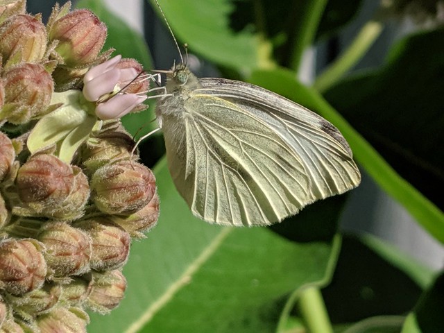
Butterfly on milkweed

I'm still not doing great with having a coherent theme; this month includes articles on biodiversity, remote sensing, dams, and coastal wetlands. The picture above is the first butterfly I've seen in my butterfly garden this year, eating from the first milkweed flower to open. After reading Sánchez-Bayo & Wyckhuys you may want to plant some too! If you know someone who wants to sign up to receive these summaries, they can do so at http://bit.ly/sciencejon


BIODIVERSITY:
The U.N.'s Intergovernmental Science-Policy Platform on Biodiversity and Ecosystem Services (IPBES) released a summary of a major report in May describing global biodiversity loss and extinctions (Diaz et al. 2019). The short version is "nature is in trouble, and so are we as a result." The most reported estimate is that about 1 million species face extinction (many within decades) unless we act to prevent that. I'd recommend looking at the policy summary and at least reading the bold headlines to get a bit more of the key findings. A few others worth highlighting include: declines in crop and livestock diversity is undermining agricultural resilience, drivers of change in nature (e.g. land use, direct exploitation, climate change, pollution, and invasives) are accelerating, goals like the Aichi Biodiversity Target and the 2030 Agenda for Sustainable Development cannot be met without major transformative changes (changes which are possible, albeit challenging), the parts of the world where declining nature is expected to hit people the hardest tend to be poor and/or indigenous communities, international cooperation to build a more sustainable global economy will be key to solve this problem, addressing the sustainability of food will also be important, and land-based climate solutions (e.g. bioenergy plantations and afforestation) have some tradeoffs. Many of these are obvious; the summaries under each headline often include useful detail, but there's too much to summarize at this level. So skim through and dive into the topics that pique your interest.

Sanchez-Bayo & Wyckhuys 2019 looks across 73 studies of insect decline from cross the world, and look at the drivers and other commonalities. A key limit of the paper is that they excluded any study that did NOT show a chance in abundance or diversity, so it's utility is limited to explaining declines where they have happened (see section 4.1). The take-away is that habitat loss seems to be the primary driver (~50% of declines), followed by 'pollution' (~26%, mostly pesticides and fertilizer), then disease and invasive species (18%) and climate change (7%). That means a sole focus on pesticides will miss key drivers of the problem. Figure 3 has a breakdown by taxonomic order, highlighting that dung beetles are in real trouble.


REMOTE SENSING:
Raber and Schill 2019 is a methods paper describing their use of a cheap (<$5k) floating semi-autonomous drone to capture mm-scale 3D imagery of shallow coral reefs. The idea is to be able to track fine scale changes over time in coral more cheaply and accurately than using divers. They note that GPS accuracy was a problem but since the paper was written the authors have added a low cost RTK GPS at the nearest coast to solve that. The paper has lots of detail for anyone interested in trying it.

Pettorelli et al. 2018 is an overview of remote sensing of ecosystem functions (as opposed to the more commonly measured structure and composition). It's a good read, but for most people I'd recommend skipping to table 3 for an overview of existing sensors and data products that can map proxies of ecosystem function, and table 4 for some new and upcoming sensors and products.


DAMS:
Ezcurra et al. 2019 looks at how dams impact sediment transport in tropical estuaries, by comparing two undammed rivers to two dammed ones (see Fig 2 & 3 for a visual summary). They found that the coastal erosion due to dams leads to environmental impacts (fisheries decline, lost coastal protection, GHG emissions from eroded sediment, biodiversity loss) that may exceed the benefits of hydroelectric production on avoided GHG emissions. However, several assumptions in the paper are problematic (e.g. all eroded sediment is lost to the atmosphere as CO2 or methane), and likely pull towards overestimating the impacts. I'd focus more on the coastal changes than the potential implications.


COASTAL WETLANDS / BLUE CARBON:
Rogers et al. 2019 finds that coastal wetlands experiencing relative sea level rise (via either sea level rise or subsiding sea floor, or even sediment compaction and decomposition) sequester and store more soil carbon. They looked at relative levels over the last 6,000 years and how it related to soil carbon at different depths, as well as a site in Australia where there was rapid relative sea level rise in the last few decades. Their explanation is that as sediment accumulates, without relative sea level rise, the space available for vegetation shrinks, and thus organic sediment accumulates more slowly.


REFERENCES:
Ezcurra, E., Barrios, E., Ezcurra, P., Ezcurra, A., Vanderplank, S., Vidal, O., … Aburto-Oropeza, O. (2019). A natural experiment reveals the impact of hydroelectric dams on the estuaries of tropical rivers. Science Advances, 5(3), eaau9875. https://doi.org/10.1126/sciadv.aau9875

Díaz, S., Settele, J., Brondízio, E., Ngo, H. T., Guèze, M., Agard, J., … Zayes, C. (2019). Summary for policymakers of the global assessment report on biodiversity and ecosystem services-unedited advance version. Retrieved from https://www.ipbes.net/news/ipbes-global-assessment-summary-policymakers-pdf

Pettorelli, N., Schulte to Bühne, H., Tulloch, A., Dubois, G., Macinnis-Ng, C., Queirós, A. M., … Nicholson, E. (2018). Satellite remote sensing of ecosystem functions: opportunities, challenges and way forward. Remote Sensing in Ecology and Conservation, 4(2), 71–93. https://doi.org/10.1002/rse2.59

Raber, & Schill. (2019). Reef Rover: A Low-Cost Small Autonomous Unmanned Surface Vehicle (USV) for Mapping and Monitoring Coral Reefs. Drones, 3(2), 38. https://doi.org/10.3390/drones3020038

Rogers, K., Kelleway, J. J., Saintilan, N., Megonigal, J. P., Adams, J. B., Holmquist, J. R., … Woodroffe, C. D. (2019). Wetland carbon storage controlled by millennial-scale variation in relative sea-level rise. Nature, 567(7746), 91–95. https://doi.org/10.1038/s41586-019-0951-7

Sánchez-Bayo, F., & Wyckhuys, K. A. G. (2019). Worldwide decline of the entomofauna: A review of its drivers. Biological Conservation, 232(January), 8–27. https://doi.org/10.1016/j.biocon.2019.01.020

Friday, May 3, 2019

May 2019 science journal article summary

Pretty flower

Merry May!

This month's summary is a bit of a grab bag as I settle into my new job and am reading a wide variety of topics.

I'm very happy to report that after about 5 years, a book I contributed a chapter to is finally published! The chapter is "Using environmental metrics to promote sustainability and resilience in agriculture" (co-authored by Peter Kareiva) and it's in "Agricultural Resilience: Perspectives from Ecology and Economics" from Cambridge University Press: https://www.cambridge.org/gb/academic/subjects/life-sciences/ecology-and-conservation/agricultural-resilience-perspectives-ecology-and-economics?format=PB

Unfortunately I wrote it when I knew far less about agriculture (and how to write well), so I can't entirely recommend it (especially all the specific metrics). But it has some useful content. The section "Food labels and sustainability" is still unique as far as I know in providing a concise (2 page) summary of research around food labels and consumer preferences around sustainability (although there are more comprehensive resources, e.g. "The Green Bundle" by Magali Delmas and David Colgan). The corporate sustainability information is badly dated but a decent primer for folks new to the field. Anyway, you can read my chapter here if interested: http://fish.freeshell.org/publications/FisherKareiva_CUP_2019_preformatted.pdf or buy the book from the link above. I haven't seen any of the other chapters yet but hopefully given the long wait they're all fantastic!

Also, normally when I find a paper not as useful as I hoped I don't review it. This month I'm including a couple that I'd normally skip since it may also be useful to see limitations flagged for papers which may be used to overstate a case.

To sign up to receive these summaries, visit http://bit.ly/sciencejon


CLIMATE CHANGE:
Anderson et al. 2019 argues that while investing in natural climate solutions (aka NCS, e.g. trees) is important to mitigate climate change, cuts to emissions from energy and industry are also urgent and imperative. As they put it, it's not "either/or" but "yes, and." Their key point is that while NCS offer many benefits, delaying emissions reductions from energy and industry by even a few years can add up to more than offset the reductions from NCS. They close by calling for conservationists to ensure that NCS mitigation is optimized, while also amplifying the need to work on complementary solutions to reduce anthropogenic emissions at their source.

Dinerstein et al. 2019 is a new spin on an older 'half earth' idea. They outline a "global deal for nature:" an ambitious plan for new protected areas and "other effective area-based conservation measures" (OECMs) which could include indigenous reserves and well-managed grazing areas. By 2030 they seek 30% of earth to be formally protected (currently we're at 15%) plus 20% more as 'climate stabilization areas.' The goal would be to minimize climate change and species extinctions via a companion to the Paris agreement, since preventing habitat loss and maintaining connectivity is much easier and cheaper than restoration after the fact. The paper is useful in identifying key areas for protection and potential policy mechanisms to consider. But Table 3 makes it clear that this is a wish list of several big policies that the environmental movement has been unable to achieve, without a plausible path to galvanize new support and/or come up with creative solutions beyond keeping humans out of most of the planet.

Searchinger et al. 2018 is an attempt to calculate the "carbon opportunity cost" of different ag land uses and habitats. Unfortunately, the assumptions taken together make this paper not very useful. For example, the idea that if food is not produced somewhere it simply will be produced elsewhere with global average values is a big stretch, but it's even more of a stretch to assume that intensifying production in one place will lead to land sparing elsewhere.


WILDLIFE CONNECTIVITY:
Dickson  et al. 2019 is an overview of how electrical "circuit theory" has been incorporated into the science of wildlife connectivity (mostly through an open source tool called circuitscape). Some key advances: recognizing that wildlife don't typically know and use a single optimal path, identifying pinch points that limit flow, and better explaining genetic patterns across a landscape. However, for animals with better knowledge of their landscape (e.g. seasonally migrating ungulates), circuit theory does not perform as well. They close with a quick summary of other applications in groundwater and fire. Check out figure 3 for a great example of how to make a basic bar chart fun and accessible.


SEAGRASSES:
Armitage and Fourqurean 2016 looked at how nutrient availability (both historic and manipulated) impacted seagrass biomass and soil organic carbon (SOC). Sites with a history of lower nutrient availability had lower soil SOC and much lower biomass (both above-ground and below-ground). Adding nutrients boosted above-ground biomass (especially P in nutrient-poor sites, with a smaller effect of N in moderate-nutrient sites), but below-ground biomass didn't respond as consistently. In fact, more sites lost below-ground biomass with extra P than gained it (the abstract misstates the findings). While it would have taken a longer study to accurately detect SOC changes due to biomass inputs, it actually went down with P addition. The authors hypothesize that the extra above-ground biomass from fertilization could trap more sediment and lead to higher SOC, which is plausible, but would have to be tested by a future study (as well as checking for impacts on N2O that could offset the C gains).

Kovacs et al. 2018 mapped seagrass in Australia (in clear shallow waters, ideal conditions) using four satellite sensors with pixel size from 30m to 2m. The results are surprising - overall all sensors had similar overall accuracy for both species ID and % cover. As expected, higher resolution  made it possible to see more detail (Figure 2 is great to compare sensors), but since it wasn't more accurate that would only be relevant if fine-scale distribution patterns were of special interest. Otherwise sticking with the coarser data would save time and money for mapping.


REMOTE SENSING:
Two new lidar satellites were launched recently: ICESat-2 launched in Sep 2018 and GEDI in Dec (initial GEDI data should be released in June, ICESat-2 hasn't announced a date yet). While GEDI is more focused on measuring forest canopy height, ICESat-2 is also mapping vegetation (in addition to ice sheets, clouds, land surface, and more). GEDI will focus on middle latitudes, and ICESat-2 on the poles. Having these data available globally will be a big deal, especially for estimating forest carbon. For more on ICESat-2, Neuenschwander and Pitts 2019 has details on one of the planned data products (ATL08) which maps both ground surface and tree canopies. It's a dense paper, but Figures 4 & 8 are useful to get a sense of the output (they used simulated data), and the discussion has several useful details. The raw data is grouped into 100m cells to have enough photons per cell, but another data product (ATL03) maps each photon individually and can be used to investigate patterns within each 100m cell. Note that tree canopy height is consistently underestimated by ATL08.


SUSTAINABLE AGRICULTURE:
Sun et al. 2018 argues that countries that import crops may also create local pollution problems, contrary to the usual thought that importing food shifts the environmental burden to the exporting country. Their case study shows that as China started importing more soy and growing other crops domestically, their nitrogen overuse increased. However, that doesn't make a strong general case for their assertion, and while China could certainly benefit from more soy rotation, fertilizer overuse there is driven by a series of political and cultural factors that again make it hard to generalize.


REFERENCES:
Anderson, C. M., DeFries, R. S., Litterman, R., Matson, P. A., Nepstad, D. C., Pacala, S., … Field, C. B. (2019). Natural climate solutions are not enough. Science, 363(6430), 933–934. https://doi.org/10.1126/science.aaw2741  

Armitage, A. R., & Fourqurean, J. W. (2016). Carbon storage in seagrass soils: long-term nutrient history exceeds the effects of near-term nutrient enrichment. Biogeosciences, 13(1), 313–321. https://doi.org/10.5194/bg-13-313-2016

Dickson, B. G., Albano, C. M., Anantharaman, R., Beier, P., Fargione, J., Graves, T. A., … Theobald, D. M. (2018). Circuit-theory applications to connectivity science and conservation. Conservation Biology, 33(2), 239–249. https://doi.org/10.1111/cobi.13230

Dinerstein, E., Vynne, C., Sala, E., Joshi, A. R., Fernando, S., Lovejoy, T. E., … Wikramanayake, E. (2019). A Global Deal For Nature: Guiding principles, milestones, and targets. Science Advances, 5(4). https://doi.org/10.1126/sciadv.aaw2869

Fisher, J.R.B. and Kareiva, P. 2019. Using environmental metrics to promote sustainability and resilience in agriculture. In Gardner et al. (Eds), Agricultural Resilience: Perspectives from Ecology and Economics. Cambridge University Press

Kovacs, E., Roelfsema, C., Lyons, M., Zhao, S., & Phinn, S. (2018). Seagrass habitat mapping: how do Landsat 8 OLI, Sentinel-2, ZY-3A, and Worldview-3 perform? Remote Sensing Letters, 9(7), 686–695. https://doi.org/10.1080/2150704X.2018.1468101

Neuenschwander, A., & Pitts, K. (2019). The ATL08 land and vegetation product for the ICESat-2 Mission. Remote Sensing of Environment, 221 (April 2018), 247–259. https://doi.org/10.1016/j.rse.2018.11.005

Searchinger, T. D., Wirsenius, S., Beringer, T., & Dumas, P. (2018). Assessing the efficiency of changes in land use for mitigating climate change. Nature, 564(7735), 249–253. https://doi.org/10.1038/s41586-018-0757-z

Sun, J., Mooney, H., Wu, W., Tang, H., Tong, Y., Xu, Z., … Liu, J. (2018). Importing food damages domestic environment: Evidence from global soybean trade. Proceedings of the National Academy of Sciences, 115(21), 5415–5419. https://doi.org/10.1073/pnas.1718153115


Sincerely,

Jon

p.s. If you'd like to keep track of what I write as well as what I read, I always link to both my informal blog posts and my formal publications (plus these summaries) at http://sciencejon.blogspot.com/

Thursday, November 1, 2018

November 2018 science journal article summary

Hi there,

Here are some mixed articles focused on general conservation, global agriculture, no-till farming, and remote sensing. Let me know if you need a copy of any of them. If you know someone who wants to sign up to receive these summaries, they can do so at http://eepurl.com/diB0nr

Also for anyone attending TNC's Global Science Gathering in Houston - let me know if you'd like to join for a side meeting for scientists working on sustainable agriculture.

CONSERVATION (GENERAL):
For over a year now, TNC staff have been hearing about a science analysis asking whether it's possible for both people and nature to thrive (in a shared conservation vision). Tallis et al 2018 is the newly available science paper behind that analysis. It compares two 2050 global scenarios: business as usual (BAU), and one designed to improve human and environmental outcomes (Sustainability). The latter would result in 577 million ha more habitat than BAU, while limiting climate change, improving air quality, and more. It doesn't assume we can drastically change diets, and sticks with biophysical constraints, but it does recognize that there are major social, economic, and political barriers to making the sustainability scenario a reality. The discussion has several thoughtful limits and caveats, but it's still exciting to see what is at least possible, if not easy to achieve. You will have to read the supplemental material to get a good sense of the work, but the main paper is conveniently short. One final note is that they assume climate change won't impact ag much in either scenario, which is optimistic. You can read all about the paper and its findings here: https://www.nature.org/en-us/what-we-do/our-insights/perspectives/the-science-of-sustainability/?vu=r.v_twopaths

The Nature Conservancy has recently shifted priorities away from land protection in general, to focusing on larger areas (to reduce fragmentation and improve resilience). Armsworth et al. 2018 asks how that focus affects the ecological return on investment (ROI). They found that larger areas are the most efficient way to improve connectivity and reduce fragmentation, offering 2-3 times the ecological return compared to small sites (TNC can buy properties that are 10x the size for just 5x the cost). However, smaller areas offer 5-8 times the ecological ROI for the number of species protected. Optimizing for species persistence rather than simply presence again favors larger areas (although the authors caution that this finding may be an artefact). These findings aren't surprising, but they are an important reminder that protecting some small areas will likely be important to protect endemic species.

GLOBAL AGRICULTURE:
Springman et al. 2018 asks what it would take to sharply reduce the impact of global food production by 2050 (and stay within resource constraints) without simply offsetting impacts like GHGs through reforestation or other mitigation. They look at 3 options (diet change, tech and management, and  reducing food waste) across 5 aspects: GHGs, fresh water use, land use, nitrogen, and phosphorous. They key finding is that no one category of solution is enough, and that for GHGs in particular major diet change (towards mostly plant based foods) would have to be part of the solution. Figure 3 summarizes this set of scenarios nicely. With their medium ambition scenario, they find halving food loss and waste improves impact 6-16% (relative to 2050), improving tech and management reduces impact 3-30%, and modest diet change improves 5-29% (see Figure 2), or they could all be combined for a 25-45% reduction. Note that their findings are global averages, and some places will deviate considerably (e.g. they find nuts and seeds don't account for much overall water use, but in places like California they have a big water footprint). Check the methods for country-level data. You can read two articles about this study here: https://www.washingtonpost.com/health/2018/10/10/how-will-or-billion-people-eat-without-destroying-environment/ and here: https://www.theguardian.com/environment/2018/oct/10/huge-reduction-in-meat-eating-essential-to-avoid-climate-breakdown

Pretty et al. 2018 has good news - they show improvements in global implementation of several forms of sustainable agricultural practices. They focus on practices that they see as representing "redesign" of agriculture as part of sustainable intensification or "SI" (offering yield and environmental benefits). This includes integrated pest management (IPM), conservation agriculture / soil health practices, and several others. They find some form of "SI" practices on 29% of global farms covering 9% of global agricultural land (crop and pasture). This shows progress is being made (although much remains to do). However, one caveat is not apparent in the paper: they define these practices as inherently intensifying or yield-promoting, but do NOT filter on farms where actual increases in yield have been measured. That's important as each of these practices has the potential to boost or reduce yield depending on how it's implemented, so it's unlikely that all of these farms actually represent true sustainable intensification. The lead author told me in a message that in developing nations would always be "win-win," and in more industrialized countries environmental benefits improved but yields could go up or down or stay the same.

Williams et al. 2018 is another paper on the land sparing vs. land sharing debate, focusing on carbon stocks. They use a mix of interviews and field data to model relationships between agricultural yield and above ground carbon, and then do a bit of modeling. They found that as crop yields go up, above ground carbon goes down (as expected). Nonetheless, across the landscapes they looked at, land sparing led to the most C stocks compared to land sharing or intermediate strategies. There are a few caveats which they helpfully admit to. First, results could vary for other environmental outcomes like water quality. They didn't look at social impacts (from either farms or ecosystem services from habitat). They don't look at methane or nitrous oxide, so for intense systems with inefficient fertilizer use the C benefit would be reduced. Finally, land sparing will not happen on its own - making farms more profitable gives them incentive to clear more habitat unless there are countervailing factors (e.g. zoning, taxes or penalties for clearing, incentives, etc.). You can read a blog about this one at https://www.npr.org/sections/thesalt/2018/08/03/634344754/which-vision-of-farming-is-better-for-the-planet

AGRICULTURE / NO-TILL:
Two recent papers (both Daryanto et al. 2017) find that no-till (NT) farming can increase the loss of nutrients under some conditions. They found that NT often increases loss of nitrate (NO3-) - generally there is similar or less runoff, but more leaching. But results vary across soil textures, climate, and crop management.

For phosphorous (P), overall NT led to lower nutrients ending up in aquatic ecosystems, and less  particulate P export (except during wet years). But it increased dissolved P loss. There are lots of caveats and conditions on the results (e.g. no-till most effectively reduced particulate P from 0-3% slope, but on 4-9% slopes it actually increased P load), so it's worth reading the papers in full. A key finding of both papers is that NT has to be combined with other practices to be effective in reducing nutrient loss, that it doesn't work as well in dryland regions, and that NT benefits decrease over time so they  recommend occasional tillage (once every ~10 years) despite likely tradeoffs in soil carbon. TNC’s Carrie Vollmer-Sanders has seen similar results for P. She recommends a focus on fertilizer placement (subsurface when possible), periodic tillage (every ~10 years), and strip tillage when it’s dry enough. There's a paper about the P results here: https://www.cornandsoybeandigest.com/fertilizer/no-till-benefits-challenged

REMOTE SENSING:
Seifert et al. 2018 has two parts: a remote sensing method to detect cover crops, and an analysis of their impact on crop yields. For remote sensing, "accuracy" is complicated but their method correctly identified whether or not cover crops were present 92% of the time, which is 68% better than expected by chance alone. They relied on readily available data, so this method should be applicable elsewhere. The second piece is that they found cover crops are grown on poor performing field (presumably in an effort to improve soils as they tended to be on poor soils). After a year of cover cropping corn yields went up on average by 0.65%, and soy by 0.35%, but read the results on p6 as there's a lot of variation (from long term cover crops reducing yields, or only improving after several years, etc., varying by state and crop). Hopefully making it easier to detect cover crops will improve our ability to understand their impacts.

If you've ever done remote sensing work in the tropics, you've noticed that you often want imagery when plants are growing, aka the rainy season when clouds limit available imagery. Pedraza et al. 2018 (from several TNC colleagues and their partners) uses radar data (ALOS PALSAR, which can see through clouds) to look for farm-level deforestation in Colombia. It worked reasonably well, mostly between 62% and 100% accurate: see table 4, focusing on user and producer accuracy as overally accuracy is skewed by the high proportion of nonforest. They found that accuracy was lower in dry forests and mountainous terrain, although they improved it by integrating some optical data. It's a useful paper for anyone looking at integrating radar data for tropical remote sensing.

REFERENCES:
Armsworth, P. R., Jackson, H. B., Cho, S. H., Clark, M., Fargione, J. E., Iacona, G. D., … Sutton, N. A. (2018). Is conservation right to go big? Protected area size and conservation return-on-investment. Biological Conservation, 225(November 2017), 229–236. https://doi.org/10.1016/j.biocon.2018.07.005

Daryanto, S., Wang, L., & Jacinthe, P.-A. (2017). Impacts of no-tillage management on nitrate loss from corn, soybean and wheat cultivation: A meta-analysis. Scientific Reports, 7(1), 12117. https://doi.org/10.1038/s41598-017-12383-7

Daryanto, S., Wang, L., & Jacinthe, P. A. (2017). Meta-analysis of phosphorus loss from no-till soils. Journal of Environmental Quality, 46(5), 1028–1037. https://doi.org/10.2134/jeq2017.03.0121

Pedraza, C., Clerici, N., Forero, C., Melo, A., Navarrete, D., Lizcano, D., … Galindo, G. (2018). Zero Deforestation Agreement Assessment at Farm Level in Colombia Using ALOS PALSAR. Remote Sensing, 10(9), 1464. https://doi.org/10.3390/rs10091464

Pretty, J., Benton, T. G., Bharucha, Z. P., Dicks, L. V, Flora, C. B., Godfray, H. C. J., … Wratten, S. (2018). Global assessment of agricultural system redesign for sustainable intensification. Nature Sustainability, 1(8), 441–446. https://doi.org/10.1038/s41893-018-0114-0

Seifert, C. A., Azzari, G., & Lobell, D. B. (2018). Satellite detection of cover crops and their effects on crop yield in the Midwestern United States. Environmental Research Letters, 13(6). https://doi.org/10.1088/1748-9326/aac4c8

Springmann, M., Clark, M., Mason-D’Croz, D., Wiebe, K., Bodirsky, B. L., Lassaletta, L., … Willett, W. (2018). Options for keeping the food system within environmental limits. Nature. https://doi.org/10.1038/s41586-018-0594-0

Tallis, H. M., Hawthorne, P. L., Polasky, S., Reid, J., Beck, M. W., Brauman, K., … McPeek, B. (2018). An attainable global vision for conservation and human well-being. Frontiers in Ecology and the Environment, 1–8. https://doi.org/10.1002/fee.1965

Williams, D. R., Phalan, B., Feniuk, C., Green, R. E., Williams, D. R., Phalan, B., … Balmford, A. (2018). Carbon Storage and Land-Use Strategies in Agricultural Landscapes across Three Continents. Current Biology, 28(15), 2500–2505. https://doi.org/10.1016/j.cub.2018.05.087


Sincerely,

Jon

p.s. as a reminder, you can search all of the science articles written by TNC staff (that we know of) here http://www.conservationgateway.org/ConservationPlanning/ToolsData/sitepages/article-list.aspx
(as you publish please email science_pubs@tnc.org to help keep this resource current).
If you'd like to keep track of what I write as well as what I read, I always link to both my informal blog posts and my formal publications (plus these summaries) at http://sciencejon.blogspot.com/
Monday, October 1, 2018

October 2018 science journal article roundup

Greetings,

Here is a short set of articles on potato cultivation, groundwater, and cattle and rangelands.

If you know someone who wants to sign up to receive these summaries, they can do so at http://eepurl.com/diB0nr

POTATO CULTIVATION:
Drakopolous et al. 2016 found that reduced tillage for potatoes led to 13% lower yields (smaller tubers) but also led to higher quality and nitrogen efficiency. The quality boost wasn't enough to offset yield loss and result in net economic benefit from reduced tillage.

Myrick 2016 is a masters thesis investigating adoption (and abandonment) of a potato variety resistant to late blight (C-88) in Yunnan, China. They found smaller farmers and those closer to cities were less likely to grow it, although they noted access to seed is very limited so decisions may largely be driven by which varieties extension agents promote. The appendix has some interesting (and at times, conflicting) data on farmer perceptions.

GROUNDWATER:
Jasechko et al. 2017 makes two important points about groundwater. The first is that between 42-85% of groundwater in the upper 1 km of the ground is over 12,000 years old, as is more than half the water pumped from deeper than 250m (highlighting challenges with pumping out "fossil" water which will be very slow to recharge). The other is that while the water is very old,  half of the wells showed contamination with tritium (a radioactive isotope mostly present in the environment from nuclear weapons and testing, showing relatively recent contamination). In other words, groundwater which took millennia to recharge and get clean is being contaminated more rapidly.
You can read a blog about this one: http://www.bbc.com/news/science-environment-39715738

RANGELANDS / CATTLE / REMOTE SENSING:
Reeves and Baggett 2014 developed a relatively simple way to assess rangeland degradation using remote sensing. Essentially they compare rangelands to reference conditions (all rangelands within similar ecological classifications), and found relatively little degradation (with degradation trends almost undetectable). They list several reasons for this in the discussion, but from other work in this space I've read it seems that estimating grassland productivity and degradation remotely is fundamentally challenging and limited (especially without field data to calibrate on), and NDVI is not an ideal tool for grasslands for several reasons. Caution could be taken before assuming relatively simple remote sensing estimates of grassland condition are accurate and actionable.

Reeves et al. 2017 predicts how climate change will affect cattle in the western U.S., considering forage (quantity, interannual variability, and vegetation types) and hear stress. They expect more forage in the north, less woody plants and more grass (in general), more variation in forage quantity year to year, and more heat sress (starting 2020-2030), which taken together means more vulnerability of cattle in most places (especially in the Southwest). In northern areas, the impacts of heat stress are expected to offset the benefits of more forage (with some exceptions). The two top maps in Figure 3 has a good summary of net impacts on cattle by 2060 and 2100, with yellow to red indicating negative effects, and green to blue indicating positive ones.

REFERENCES:
Drakopoulos, D., Scholberg, J. M. S., Lantinga, E. A., & Tittonell, P. A. (2016). Influence of reduced tillage and fertilization regime on crop performance and nitrogen utilization of organic potato. Organic Agriculture, 6(2), 75–87. https://doi.org/10.1007/s13165-015-0110-x

Jasechko, S., Perrone, D., Befus, K. M., Bayani Cardenas, M., Ferguson, G., Gleeson, T., … Kirchner, J. W. (2017). Global aquifers dominated by fossil groundwaters but wells vulnerable to modern contamination. Nature Geoscience, (April), 1–6. https://doi.org/10.1038/ngeo2943

Myrick, S. N. B. (2016). An Economic Impact Assessment of Cooperation-88 Potato Variety in the Yunnan Province of China. Virginia Polytechnic Institute and State University.

Reeves, M. C., & Baggett, L. S. (2014). A remote sensing protocol for identifying rangelands with degraded productive capacity. Ecological Indicators, 43, 172–182. https://doi.org/10.1016/j.ecolind.2014.02.009

Reeves, M. C., Bagne, K. E., & Tanaka, J. (2017). Potential Climate Change Impacts on Four Biophysical Indicators of Cattle Production from Western US Rangelands. Rangeland Ecology and Management, 70(5), 529–539. https://doi.org/10.1016/j.rama.2017.02.005


Sincerely,

Jon

p.s. as a reminder, you can search all of the science articles written by TNC staff (that we know of) here http://www.conservationgateway.org/ConservationPlanning/ToolsData/sitepages/article-list.aspx

Friday, August 25, 2017

New paper and two blogs asking "how much data is enough?"


My new paper (Impact of satellite imagery spatial resolution on land use classification accuracy and modeled water quality) is essentially an analysis for the Camboriú water fund of how the choice of input data impacts the decision you'd make as a result. We compared a relatively quick analysis on free 30 m resolution data to a more complex analysis using 1 m data. I'd recommend most people skip most of the paper (which is quite technical) and skip to the discussion, or even the two blogs I wrote about it.

The first blog explains the overall project and the paper at a high level here:
Camboriú Conservation Field Test: How Much Data is Enough?

I also wrote a second blog aimed specifically at people who actually do spatial analysis to guide them in picking the right source of remotely sensed imagery:
How much data is enough? Investigating how spatial data resolution impacts conservation decision making

In short, we found that the simpler analysis would have led us to the same decision in Brazil, but that for other water funds the choice of data could be critical. The return on investment was over 1 with 1m data, but below 1 with 30m data, meaning if financial return was the dominant factor this distinction would be critical.

Table 5 and the discussion have several guidelines to consider in how to select whether relatively low or high resolution data is most appropriate for a given context. I'm pretty excited about that part of the paper, and I'd really welcome feedback on it from anyone so inclined.


Thursday, May 25, 2017

New paper: using high resolution satellites to map agricultural practices in Kenya


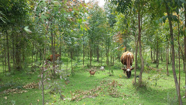
My latest paper (Ayana et al. 2017) describes a method we used to map drainage ditches and furrows (a few examples shown above) on farms in Kenya (specifically the Sasumua region of the Upper Tana, Northwest of Nairobi) using high-resolution satellite imagery, and has a rough analysis showing that these features could be reducing sediment export in the study area by about 80%. The technical aspect which is the core of the paper will not be of interest to many people reading this. But the key point is that it's important to have this information to build a reasonable water quality model of the area, and this method makes acquiring that information possible (it would be too expensive to map via field work alone). You can download it from http://fish.freeshell.org/publications/Ayana2017-IdentificationOfDitchesAndFurrows-AcceptedManuscript.pdf.

Friday, September 9, 2016

New journal article: "Examining the relationship between environmental factors and conflict in pastoralist areas of East Africa"

A research fellow of mine (Essayas Ayana) recently published an analysis (which I'm also an author on) of the degree to which environmental factors like drought drive conflict between pastoralists. The idea was that as the lands where they graze their animals dry up, they may be forced to graze in areas used by others, which could drive conflict. However, we found that environmental variables had very little predictive power for where conflict occurred. The paper is officially hosted here:
http://www.sciencedirect.com/science/article/pii/S0048969716305265

You can read the full text of the paper here:
https://www.researchgate.net/profile/Essayas_Ayana2/publication/299520493_Examining_the_relationship_between_environmental_factors_and_conflict_in_pastoralist_areas_of_East_Africa/links/572b8f9708aef7c7e2c6b569.pdf

Here's the citation:
Ayana, Essayas K., Pietro Ceccato, Jonathan RB Fisher, and Ruth DeFries. "Examining the relationship between environmental factors and conflict in pastoralist areas of East Africa." Science of The Total Environment 557 (2016): 601-611.


20150611_124650

Thursday, November 5, 2015

Using drones (UAVs) to measure turbidity (water quality) in small streams

I didn't write this myself, but I wanted to post the link anyway since this is a project I have been working on closely from design to data collection to analysis, along with a research fellow (Essayas Kaba Ayana) at Columbia University that I'm mentoring through the NatureNet program. We originally hoped to do this work in Kenya but legal and logistical difficulties required us to switch to Maryland:
http://blog.nature.org/science/2015/11/05/drones-in-the-field/