Showing posts with label conservation planning. Show all posts

Tuesday, March 1, 2022

March 2022 science summary

Winter biking


 Hello,


I've got a mix of papers this month but most relate to climate change (priorities for mitigation and adaptation, impacts on flooding, and how to plan for it) plus a couple of wildlife movement. 

If you know someone who wants to sign up to receive these summaries, they can do so at http://bit.ly/sciencejon (no need to email me).

CONSERVATION PRIORITIES / 30x30 / CLIMATE ADAPTATION:
Dreiss & Malcom 2022 is an analysis of priorities for protection under 30x30, considering hotspots of biodiversity and carbon, current protection (Fig 2), and threats. The two threats are risk of conversion (to non-habitat by 2050) and climate vulnerability (need for habitat / species to migrate elsewhere to survive, expressed in km/yr). They have two sets of hotspots, one with the top 10% of biodiversity (they calculated both imperiled species richness, and imperiled species range-size-rarity which captures how much habitat rare spp. have left), and one with the top 10% of carbon pools (not actual GHG mitigation potential, as it omits deep carbon like peat, other GHGs, and the albedo effect). Fig 3 has maps of their main results, but they're easier to see and explore in the interactive map at https://arcg.is/0SjGLK. Fig 4 highlights high conversion risk (>50%) and climate vulnerability for hotspots (top 10%) of biodiversity and carbon (4a = conversion & richness, 4b = conversion & carbon, 4c = climate vuln. & richness, 4d = climate vuln. & carbon). Upgrading all existing less strict protected areas (GAP 3) would achieve ~30% protection, but that would miss 80% of biodiversity hotspots (which are on private land). Similarly, 21% of unprotected biodiversity hotspots have at least a 50% chance of being converted by 2050. The authors didn't include political, social, or economic considerations, but there are still a lot of useful data in here.

Dreiss et al. 2022 identifies priority conservation locations within the contiguous US to support climate adaptation (via refugia and corridors). Fig 4c shows which climate refugia and corridors are unprotected (in gray) or underprotected (GAP 3 in orange). The bottom two rows in Table 3 shows that the best places for climate adaptation mostly don't overlap with the best places for biodiversity or carbon (~20-25% do). This means that focusing solely on biodiversity or carbon hotpsots is likely to miss critical refugia and corridors to help ensure resilience to climate change.


CLIMATE CHANGE IMPACTS:
Wing et al. 2022 modeled increasing US flooding risks due to both climate change (by 2050 under RCP4.5, which is 'medium' emissions but still means aggressive decarbonization) and changing populations. Note that the paper uses 'risk' in the engineering sense: likelihood of impact times magnitude of impact (so risk is reported as expected annual $ losses due to floods). Those losses are expected to go up 26% just from climate change (calculated at the building level based on current population data), but considering both climate change and population change they predict almost twice as many people will be impacted by flood each year (with that impact driven largely by population growth). The highest current flood risk is in predominantly white and extremely poor counties (partly b/c very poor people in areas at risk of floods have few financial assets not vulnerable to floods, so their relative risk is higher). The counties with the highest % Black population are expected to see twice as much risk increase by 2050 as counties with the fewest Black people. This is due a mix of increasing flooding risk in the Deep South, and the relatively low current risk of mostly Black counties. You can read more about this at https://www.washingtonpost.com/business/2022/01/31/climate-change-flooding-united-states/

Brown et al. 2022 has a good overview of recent improvements to incorporating climate change into conservation planning via the Conservation Standards (aka Open Standards for the Practice of Conservation). If you're not familiar with the Standards, this paper will be a bit overwhelming, but still has useful tidbits. Jump to figure 4 for a very helpful diagram of physical changes expected to result from climate change, and which of these changes make sense to classify as "direct climate threats" (in red text). What I love about this is it helps you move past (climate change will affect everything) and identify the specific changes that a) will affect focal species and ecosystems, and b) which you can affect via conservation. So rather than focusing on changes to rain, they identify decreased water availability and increased risk of landslides as climate threats. Then Fig 5b shows how the climate threats are integrated w/ other direct threats and linked to conservation targets (the species and ecosystems being prioritized for action). If you can handle switching examples, Figs 6 and 7 show how to move from a situation model (linking threats to targets and identifying possible strategies) to a results chain (showing the desired interim results and ultimate impacts of a strategy). There is some updated guidance available since this was published on the CMP web site.


WILDLIFE MOVEMENT / MIGRATION:
Merkle et al. 2022 addresses the problem that species which favor returning to fixed places to forage / breed / shelter have a hard time adjusting to habitat loss and resulting fragmentation. Figure 2 has a good example: mule deer in WY staying true to winter range despite oil & gas development, which the authors give as an example of an 'ecological trap' due to 'site fidelity' (they keep coming back even if they have better alternatives). They call for more research on what drives site fidelity (genetics, environmental conditions, or a mix), and for conservation plans to account for site fidelity rather than assuming animals will choose the best habitat possible.

Vynne et al. 2022 is a global analysis to find terrestrial ecoregions where only 1-3 large mammals (>33 lb, 298 species) are missing from the mammals that present 500 years ago (Fig 2 has a map of those results). Given the impact large mammals have on ecosystems, the idea is that getting back to the full suite of mammals that used to be there will have broader effects. But this is an assumption the authors make, rather than a conclusion of the analysis (most news headlines have implied the latter). The best known example of that is the impact of reintroducing wolves to Yellowstone leading to a trophic cascade (although unfortunately those effects have been widely exaggerated due to non-random aspen sampling and failing to account for confounding effects of human hunting and changes in streamflow due to climate). Their 30 priority ecoregions for reintroduction / restoration are in Table 2 and Figure S3. They note the challenges in reintroducing predators in particular, including the need to plan to avoid human conflict and difficulty of securing protection over large areas to allow for connectivity).


REFERENCES:

Brown, M. B., Morrison, J. C., Schulz, T. T., Cross, M. S., Püschel-Hoeneisen, N., Suresh, V., & Eguren, A. (2022). Using the Conservation Standards Framework to Address the Effects of Climate Change on Biodiversity and Ecosystem Services. Climate, 10(2), 13. https://doi.org/10.3390/cli10020013

Dreiss, L. M., & Malcom, J. W. (2022). Title identifying key federal, state, and private lands strategies for achieving 30 × 30 in the United States. Conservation Letters, May 2021, 1–12. https://doi.org/10.1111/conl.12849

Dreiss, L. M., Lacey, L. M., Weber, T. C., Delach, A., Niederman, T. E., & Malcom, J. W. (2022). Targeting current species ranges and carbon stocks fails to conserve biodiversity in a changing climate: opportunities to support climate adaptation under 30x30. Environmental Research Letters, 2(1), 0–31. https://doi.org/10.1088/1748-9326/ac4f8c

Merkle, J. A., Abrahms, B., Armstrong, J. B., Sawyer, H., Costa, D. P., & Chalfoun, A. D. (2022). Site fidelity as a maladaptive behavior in the Anthropocene. Frontiers in Ecology and the Environment, 1–8. https://doi.org/10.1002/fee.2456

Vynne, C., Gosling, J., Maney, C., Dinerstein, E., Lee, A. T. L., Burgess, N. D., Fernández, N., Fernando, S., Jhala, H., Jhala, Y., Noss, R. F., Proctor, M. F., Schipper, J., González‐Maya, J. F., Joshi, A. R., Olson, D., Ripple, W. J., & Svenning, J. (2022). An ecoregion‐based approach to restoring the world’s intact large mammal assemblages. Ecography, 1–12. https://doi.org/10.1111/ecog.06098

Wing, O. E. J., Lehman, W., Bates, P. D., Sampson, C. C., Quinn, N., Smith, A. M., Neal, J. C., Porter, J. R., & Kousky, C. (2022). Inequitable patterns of US flood risk in the Anthropocene. Nature Climate Change. https://doi.org/10.1038/s41558-021-01265-6

Sincerely,
 
Jon
 
p.s. If you'd like to keep track of what I write as well as what I read, I always link to both my informal blog posts and my formal publications (plus these summaries) at http://sciencejon.blogspot.com/
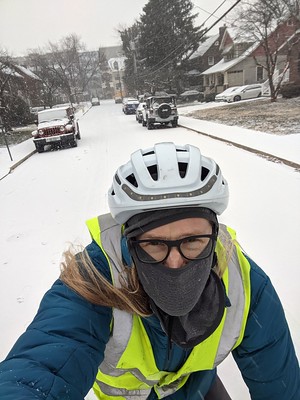
p.p.s. As shown in the pic above - I am a committed winter biker, and my wife and I very much enjoyed Arlington's winter bike games recently!

Monday, November 1, 2021

November 2021 science summary

Meteor by Robert Roselle

Hello,


This month I am summarizing a mixed bag of science articles on conservation planning, climate change, fire & human health, and wildlife monitoring.

I was interviewed by Wildhub about things I've learned as a conservation scientist (especially related to publishing papers), if you're interested it's available at: https://wildhub.community/posts/communicating-your-message-is-crucial-and-it-takes-lots-of-practice

Also the 2021 Annual Request for Proposals (RFP) from The Science for Nature and People Partnership (SNAPP) is now open. You can learn more and apply at https://awards.snappartnership.net/ (proposals due by December 10th), but they fund quick working groups to advance research w/ tangible benefits to people and nature.

If you know someone who wants to sign up to receive these summaries, they can do so at http://bit.ly/sciencejon

CONSERVATION PLANNING:
Lees et al. 2021 is an interesting analysis of the impact of participatory and stakeholder-inclusive conservation planning on threatened species. They specifically look at the 35 planning workshops hosted by The Conservation Planning Specialist Group (CPSG) of the IUCN Species Survival Commission (IUCN SSC) which had data for at least 5 years before the workshop and 10 years after on the species in question (using the Red List Index). The abstract tells a rosier picture than does Table 1: 10 years after workshops 4% of spp improved, 22% declined, and 74% were stable (after 15 years it was 9%, 26%, and 66%). But 1) they show that the decline slowed down post-workshop relative to pre-workshop, and 2) relative to a modeled counterfactual (w/o the workshops) they predicted that 8 species extinctions were avoided (of the 35 spp. with 15 years of post-workshop data). Check out Fig 3 for the mean risk over time which makes their point well. While it's posisble the 15 year data is an anomaly, in the discussion on p6 they make a good case that the workshops were the secret sauce rather than some other factor. Since they take place in contexts where past conservation has been unsuccessful and the path forward was unclear due to conflicting views and uncertainty, the pre-workshop outlook was typically poor, and actively including stakeholders in planning was a good way to both find solutions and build support for them. Studying the impact of planning per se is very difficult, and I don't see this paper as definitive proof, but it is useful evidence making a case for broad and inclusive planning that involves a range of stakeholders.


CLIMATE CHANGE:
Dobrowski et al. analyzes how much of the world will experience enough climate change to effectively shift into a different ecoregion, and how that relates to protected areas (PAs). They move ecoregions' location to keep their historic climate similar, which is an interesting thought exercise but not a likely scenario (given variations in soil and topography and other factors that will not shift w/ climate). They found that with 2C warming, 54% of land will effectively change ecoregions, with 22% shifting biomes (see Fig 4 for how this affects % protected by biome). This means there are winners and losers, with the biggest losers the ~5% of land within PAs that don't have an analogous climate w/in 2000 km for species to migrate to (shown in black in Figs 2b & 3b; 56 ecoregions 'disappear'). They recommend a focus on unmodified areas expected to be climatically stable that are currently underprotected, as well as areas that improve climate connectivity (see Fig 6 for a case study in the NW US and Canada). They also have a tool where you choose a place, and it'll tell you what other place currently has the climate the first place is expected to have w 2C (or 4C) warming: https://plus2c.org/


FIRE & HEALTH:
Liu et al. 2017 combines modeled smoke exposure from wildfire with hospital admission data (due to respiratory illness) to estimate the health impacts of fire on different groups of elderly Medicare enrolees. Specifically, they looked at age, gender, race, urban/rural, region, poverty level, and education (see Table 2) in 561 counties in the Western US. They looked at baseline hospital admissions for respiratory illness for each group, and then how that changes on days when smoke levels are high. They found more smoke exposure in Blacks, California, urban, and more educated counties. Hospital admissions on smoke days increased the most for Blacks (22%) and women (10%). There are a few odd findings (like poor people having more smoke exposure, but decreased hospital admissions on smoke days), and they also used a bad practice of having a 'referent' population that was white, make, urban, and relatively wealthy and young.

Palaiologou et al. 2019 looked at how different aspects of the Social Vulnerability Index affect wildfire exposure in parts of three states (WA, CA, NM). They grouped social attributes oddly rather than using the default SVI themes (see Table 2: I'm unclear why 'minority' ends up in 'education'), but found fire exposure went up w/ poverty & disability, higher population & # of households, youth, inability to speak English, and lack of high school education (but with variation by state). They found that most fire exposure for the most vulnerable places originated on private land relatively near to both towns and "wildlands."


WILDLIFE MONITORING:
Lahoz-Monfort & Magrath 2021 is an overview of tech options for monitoring wildlife (excluding biotechnology like eDNA and genomics) and to a lesser degree collecting other environmental information. Since they cover a wide range of tech fairly shallowly, it's hard to summarize. It's worth a quick read for anyone looking to understand the range of ways scientists track and measure wildlife from afar. They cover types of sensors (chemical, thermal, optical including UV and IR but broken out from multispectral and hyperspectral and LiDAR, radar, active sonar, passive acoustic, vibration, and position / motion), specific devices (visible and thermal camera traps, microphones w/ loggers, sonar on boats or buoys, land-based radar like Doppler, smartphones, and a few others), networks of devices (wireless or independent but with data harvested and combined later), devices on land and water vehicles, traditional remote sensing (from planes, satellites, and drones), devices on animals (which can track: location via several tech options, physiological info like temperature and heart rate or even birth, imagery, audio, individual identity, interactions w/ other animals, and more), other ways to track the location of wildlife, using sensors to trigger traps (or deploy poison or open / close a gate, etc.), and computing (including online platforms, smartphones, AI, and cheap computing).


REFERENCES:
Dobrowski, S. Z., Littlefield, C. E., Lyons, D. S., Hollenberg, C., Carroll, C., Parks, S. A., Abatzoglou, J. T., Hegewisch, K., & Gage, J. (2021). Protected-area targets could be undermined by climate change-driven shifts in ecoregions and biomes. Communications Earth & Environment, 2(1), 198. https://doi.org/10.1038/s43247-021-00270-z

Lahoz-Monfort, J. J., & Magrath, M. J. L. (2021). A Comprehensive Overview of Technologies for Species and Habitat Monitoring and Conservation. BioScience, 71(10), 1038–1062. https://doi.org/10.1093/biosci/biab073

Lees, C. M., Rutschmann, A., Santure, A. W., & Beggs, J. R. (2021). Science-based, stakeholder-inclusive and participatory conservation planning helps reverse the decline of threatened species. Biological Conservation, 260(December 2020), 109194. https://doi.org/10.1016/j.biocon.2021.109194

Liu, J. C., Wilson, A., Mickley, L. J., Ebisu, K., Sulprizio, M. P., Wang, Y., Peng, R. D., Yue, X., Dominici, F., & Bell, M. L. (2017). Who Among the Elderly Is Most Vulnerable to Exposure to and Health Risks of Fine Particulate Matter From Wildfire Smoke? American Journal of Epidemiology, 186(6), 730–735. https://doi.org/10.1093/aje/kwx141

Palaiologou, P., Ager, A. A., Nielsen-Pincus, M., Evers, C. R., & Day, M. A. (2019). Social vulnerability to large wildfires in the western USA. Landscape and Urban Planning, 189(April), 99–116. https://doi.org/10.1016/j.landurbplan.2019.04.006

Sincerely,
 
Jon
 
p.s. the photo above shows the inside of a sculpture called Meteor by Robert Rosselle (the last one he made before he died). The outside is less lovely (https://www.flickr.com/photos/jaundicedferret/51430890217/in/datetaken/) so it's a great surprise to peek in and see the planet and stars

Monday, February 1, 2021

February 2021 science summary

Broken apple slicer

Hello,


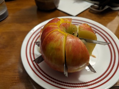
I couldn't resist sharing the image above. When my apple slicer broke, the result seemed very nightmarishly 2020 (a piece of fruit full of sharp metal)!

I've got 5 articles on freshwater this month, plus one on conservation planning across land and sea. Also, if you missed the panel discussion I hosted about how scientists can improve their impact (with Lynn Scarlett, Yoshi Ota, Christian Pohl, and Mark Reed), I learned a lot so recommend it! The recording is available here: https://www.openchannels.org/webinars/2021/how-do-science-so-it-influences-marine-policy-and-management-panel-discussion and their combined high-level advice is here: https://bit.ly/OCTO-panel-advice

If you know someone who wants to sign up to receive these summaries, they can do so at http://bit.ly/sciencejon

FRESHWATER:

The findings of Leal et al. 2020 may seem obvious, but they're important to highlight: conservation planning focused on terrestrial species only does a poor job at protecting freshwater biodiversity. They did some modeling in Brazil to look at trade-offs between freshwater and terrestrial species, and how to improve planning. Their low-bar recommendation is that even without data on freshwater biodiversity, just considering aquatic connectivity in additional to terrestrial species roughly doubles the benefit to freshwater species with almost no decrease in terrestrial benefits (Fig 3e & 3f, purple lines). If planning considers both terrestrial and freshwater biodiversity data, about a 5% decrease in terrestrial benefits leads to a ~400% increase in freshwater benefits (Fig 3e & 3f, aqua lines). This represents a strong case against assuming terrestrial work will do a good job at protecting freshwater ecosystems, and the idea of just including aquatic connectivity is an appealing entry point in places where better freshwater data are unavailable.

Improving water quality in agricultural landscapes (and downstream water bodies like the Gulf of Mexico) can be accomplished via changing inputs (e.g., using less fertilizer, or applying more stable forms at the right times), soil management to keep soil and nutrients in the field, edge-of-field practices like riparian buffers that intercept runoff, and through in-stream wetlands. Cheng et al. 2020 modeled how much nitrogen (N) wetlands remove from streams in the US (860,000 metric tons / year, and found that 10% more wetlands (+5 million hectares) could double N removal if they were in the right places (See Figs 3 & 5, although there are no big surprises here). This builds on other work about the essential role of wetlands in removing water pollution in concert with work on farms (e.g. Tomer et al. 2015 in JEQ), but highlights the need for landscape-scale planning and optimization for restoration to be as effective as possible. But one reason there are fewer wetlands in watersheds losing lots of N is that farmland tends to be productive and expensive there, and their proposal to double N removal requires losing 2% of total US cropland area. The authors also don't account for the potential increase in nitrous oxide which is a potent greenhouse gas. If you don't have the appetite for the whole article, this 1-page summary (Finlay 2020) has more detail: https://media.nature.com/original/magazine-assets/d41586-020-03515-7/d41586-020-03515-7.pdf

King et al. 2021 offer a model of the costs and benefits of removing river barriers (dams, culverts, canal locks, and even natural waterfalls) in southern England. They find the benefits of barrier removal exceed the costs, but note that benefits are only estimated via reported willingness to pay for improved species richness and abundance (which were lumped in with more publicly accessible river bank, which I think could skew the data). They estimated a cost of >53 million pounds to remove all 650 barriers on the river Wey. My real take away is that removing barriers is expensive, but if we trust reported WTP, there may be support for fees that go to barrier removal if it is likely to lead to better recreational opportunities.

Lin et al. 2020 is a overview of how historic canals impact aquatic ecosystems (both positively and negatively), and opportunities to improve their management for conservation. It's global but focused mostly in Europe and North America. Canals can harm biodiversity by providing entry to non-native species and pathogens, allowing interbreeding which reduces genetic diversity, and serve as 'ecological traps' by attracting species that will die or be heavily stressed during drought or other events. On the other hand, canals can help biodiversity by providing connectivity and migratory pathways when rivers are fragmented, as well as provide refuges from human disturbance and climate change in some cases. Regardless, thoughtful management (or intentional abandonment) can improve environmental outcomes if done well. See Fig. 3 for broad examples,  Table 1 for variables that can inform management, and Fig. 4 for which management options relate to different objectives. The authors note that canals can be challenging to balance the human needs that the canals were originally built for with conservation objectives.


CONSERVATION PLANNING
:
Tulloch et al. 2021 used Marxan w/ Connectivity for a case study (in Papua New Guinea) that looks at connections across land and sea and highlights intersections (like how forests and inshore reefs are connected). The idea was to improve on planning focused on a single realm (marine or terrestrial or freshwater). Fig 1 is a flowchart of the process they used. While the title mentions freshwater, they had no freshwater goals, and instead only used rivers as a connection between ecosystems on land and sea.

REFERENCES:
Cheng, F. Y., Van Meter, K. J., Byrnes, D. K., & Basu, N. B. (2020). Maximizing US nitrate removal through wetland protection and restoration. Nature, 588(7839), 625–630. https://doi.org/10.1038/s41586-020-03042-5

Finlay, J. (2020). Making the most of wetland restorations. Nature, 588, 592–593.

King, S., O’Hanley, J. R., & Fraser, I. (2021). How to choose? A bioeconomic model for optimizing river barrier mitigation actions. Ecological Economics, 181(March), 106892. https://doi.org/10.1016/j.ecolecon.2020.106892

Leal, C. G., Lennox, G. D., Ferraz, S. F. B., Ferreira, J., Gardner, T. A., Thomson, J. R., Berenguer, E., Lees, A. C., Hughes, R. M., Mac Nally, R., Aragão, L. E. O. C., de Brito, J. G., Castello, L., Garrett, R. D., Hamada, N., Juen, L., Leitão, R. P., Louzada, J., Morello, T. F., … Barlow, J. (2020). Integrated terrestrial-freshwater planning doubles conservation of tropical aquatic species. Science, 370(6512), 117–121. https://doi.org/10.1126/science.aba7580

Lin, H. Y., Cooke, S. J., Wolter, C., Young, N., & Bennett, J. R. (2020). On the conservation value of historic canals for aquatic ecosystems. Biological Conservation, 251(February), 108764. https://doi.org/10.1016/j.biocon.2020.108764

Tulloch, V. J. D., Atkinson, S., Possingham, H. P., Peterson, N., Linke, S., Allan, J. R., Kaiye, A., Keako, M., Sabi, J., Suruman, B., & Adams, V. M. (2021). Minimizing cross-realm threats from land-use change: A national-scale conservation framework connecting land, freshwater and marine systems. Biological Conservation, 254(July 2020), 108954. https://doi.org/10.1016/j.biocon.2021.108954


Sincerely,
 
Jon